Tuesday, 24 June 2014

Saturday 21st June 2014 Oxford Canal Walk Ramble 10: Aynho Wharf to Lower Heyford


Saturday 21st June 2014 Oxford Canal Walk Ramble 10

Aynho Wharf to Lower Heyford (Bridge 206), which is nearly 5½ miles.

We, with Margaret B, Hugh, John, Julie, Sue and Jem set out from Aynho Wharf where there is a small shop selling provisions and souvenirs and some convenient picnic benches. The weather could not have been better; brilliant sunshine with a slight breeze.

The first lock we came to, Somerton Deep Lock, vies with Tardebigge Top Lock on the Worcester & Birmingham Canal for the honour of the deepest narrow beam lock on the UK canal system. The fall is 12 feet.


Along the Oxford canal we have noticed ‘DIS’ marker posts; positioned just before and after the locks. Internet research suggests that they were used by horse boatmen to signal to the lock keeper ahead, and so claim priority for the lock over others, by cracking the whip at that point. Later it is said that horns were used. Online there is a fair bit of discussion as to how well this system would have worked.

 Continuing south along the Cherwell Valley our route became increasingly rural. The vegetation was high on both sides of the towpath in some places. We spotted butter burr, common valerian, fumitory, yellow flags, meadow cranesbill, as well as a few garden escapees (more exotic roses and poppies, love-in-the mist). Many boats had lovely displays of flowers in pots and one had a green roof.
 
 It seemed at times that we were walking alongside a river rather than a canal; the towpaths waivered slightly away from the edge of the water and, in places, brambles were growing high in-between. The rows of pollarded willows with meadows beyond helped make a ‘river-scene’ too.
 

A herd of cows (calves, cows and a bull) came close to us at one point and a family were enjoying a leisurely paddle, going the same way as us, with a new (?) inflatable canoe. 

 We were keen to make our way to the agreed picnic spot by Heyford Common Lock (35) and it seems that I may not have lingered long enough to realise that the four posts we passed had poems written on them. To mark the launch of the Canal and River Trust, Ian McMillan was commissioned to write some poetry and I think some lines have been inscribed onto balance beams from bridges and placed along here.
Allen’s lock was an idyllic place and is where we persuaded another walker to take our group picture.
 In Upper Heyford, overlooking the River Cherwell and canal, is the magnificent stone tithe barn at Manor Farm. It was built in about 1400 and is 120 feet long. A party seemed to be going on with guests chatting and drinking, enjoying the warm sunshine.

  Nearby, until 1994, was the giant Upper Heyford US airbase. Joni Mitchell’s Woodstock dream ‘the bombers in the sky have turned to butterflies’ came true! We drove back through the site, and it is now being redeveloped with housing.

At the end of our walk at Lower Heyford we saw Oxfordshire Narrowboats base, from where they hire out boats. Very close to the canal is Heyford railway station and after enjoying a cup of tea at the café, we crossed over the railway line to our cars.


Monday, 23 June 2014

Thursday 19th June 2014 Ramble 24: Bull’s Bridge to Brentford.


Thursday 19th June 2014
Ramble 24:  Bull’s Bridge to Brentford.
As we were setting off from Bull’s Bridge for our 5½ mile walk, we spotted the Tranquil Rose barge owned by Thames and Chilterns Holiday Cruises.  Ann Rowett from KDRC was aboard, up on the ‘sun deck’. We had arranged to see her later.  They were heading northwards, so it was quite fortuitous to see her at Bull’s Bridge, as this was the only point where our paths could cross!


Once, Bull’s Bridge canal junction was a very busy place as the main docks for the Grand Union Canal Carrying Company with a weighing station were here; a centre where boats would be maintained and repaired and boaters could meet up and exchange news.  Now there is little in the way of boating activity and a giant Tesco store occupies the old maintenance yard site.
So, on our way we first passed a few houses on boats –all higgledy-piggledy then Adelaide Dock with a dry dock area. Once, there was a hire company here (it was one of the last to close in London). Now, even on a sunny day in June, there seemed not to be many passing boats and the whole area needs a spruce up!
As it goes through ‘Little India’, as Southall is called, the canal sides are edged with housing. The golden domes of the largest Sikh temple domes in Europe were visible above the house roofs.  We saw many coconuts and flowers floating in the water; offerings to the gods are thrown into the canal which presumably is a stand-in for the Ganges.
 Two miles into the walk we passed Norwood Top Lock. Then we went through the Three Bridges intersection (a point where the railway line, a road bridge and canal intersect). The railway bridge was designed by Brunel and built in 1859.

Alongside the towpath here, for quite a distance, is the high brick wall of a 77 acre site upon which the Middlesex county lunatic Asylum was opened in the 1830s. It was once the largest in Europe (with more than 2000 patients) and the small dock from the canal enabled foodstuffs and coal to be delivered and rubbish taken away.  We also saw holes in the wall, low down covered with metal plates that were designed so that water hoses could be used to get water from the canal in the event of fire. Now Ealing Hospital, mental health units and houses occupy the site.  
Towards the end of the Hanwell flight of six locks, the River Brent enters the canal bringing with it seemingly dirtier water, certainly a deeper and bluer colour. We did see a few ducks, coots and terns, a heron, a young cormorant and heard some parakeets. Also, a few dragonflies and butterflies were around.
 
Osterley Lock is next, on the edge of Osterley Park (NT Georgian mansion) and then the canal passes under the M4 motorway and not long after, the Piccadilly tube line. A smaller and more attractive black and white bridge is just around a bend in the canal. It is thought to be the first cast iron bridge that Horseley Iron Works built.

More bridges carry the Great West Road A4(T) and further tube lines and roads over the canal before it reaches Brentford.
The UK pharmaceutical giant Glaxo Smith Kline’s headquarters dominates the landscape here with its smart office building that opened in 2001. Walking into Brentford, we were aware of planes descending down into Heathrow every few minutes – do residents ever get totally used to this? Plenty of blocks of new flats surround the marina.  We walked through the last remaining overhanging dock which seems to be in the process of demolition.  
At the far end of the marina next to the toll house built in 1911, are two gauging locks. Boats with cargoes were measured with a stick to assess the tolls to be levied. Nowadays boaters still have to be aware of the tide times as clearance under some bridges is limited when the tides are high. The pound between the gauging locks and Thames lock is tidal and when walking along we saw very little water there.
 The size of the boats moored on the sides increased dramatically though, and so did the complexity of our route. Paths and signs were there but the route was not obvious and people who had overtaken us ended up passing us again face to face! The large and deep Thames locks mark the end of the GUC walk and we were able to get a tantalising glimpse of the main River Thames, which in the future we hope to walk the length of.
We had a bite to eat, and then caught a 195 bus back to Bull’s Bridge. We then drove to the picturesque village of Denham to meet Ann and see Tranquil Rose and her skipper. The Country Park and golf course there were a tranquil contrast to the hustle and bustle of Brentford.


Tuesday, 17 June 2014

Thursday 12th June 2014 Oxford Canal Walk Ramble 9: Banbury to Aynho Wharf


Thursday 12th June 2014 Oxford Canal Walk Ramble 9

Banbury Centre (Bridge 168) to Aynho Wharf, which is nearly 7 miles.


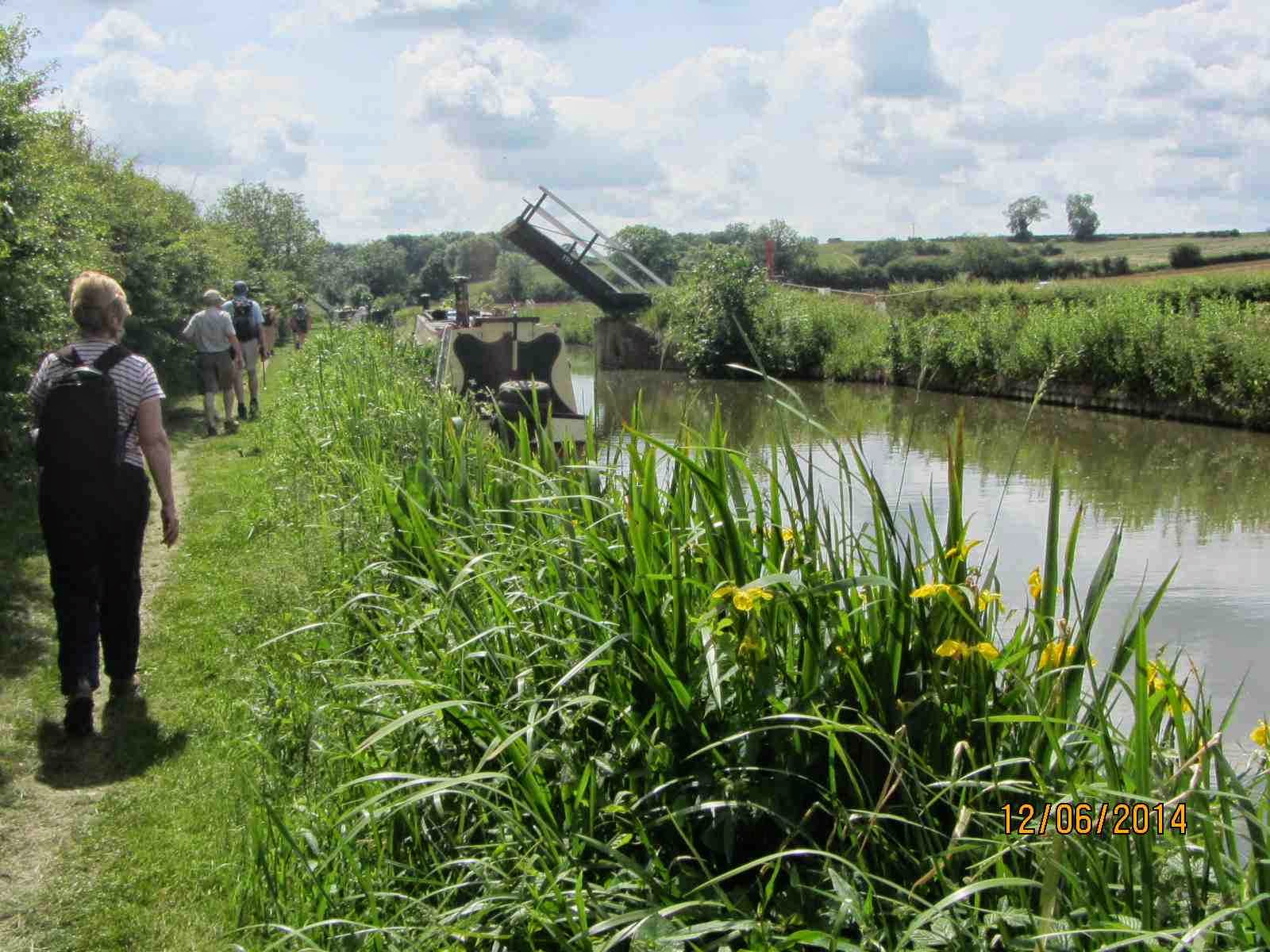
Margaret B, Hugh, Peter, Julie, Margaret C, Jean, Dot, Sue, Jem and we set out from Samuelson or Tramway Bridge (No168) and were soon walking through the outskirts of Banbury into the lush and very green countryside.

For a majority of this walk the M40 road, the Rugby to Oxford railway line and the River Cherwell are all close by and they take turns to cross the canal. This southern section of the canal, from Banbury to Oxford, was built slightly later and with economy measures in mind. Investors had fallen away as the railways became the ‘way to go ahead’. So, along here there are very deep locks with single gates, many wooden lift bridges and a scheme where the river crosses the canal.


Banburyshire was sunny and in the favourable conditions many flowers were blooming and insects flying (butter burr, yellow flag irises, common valerian, meadowsweet and banded demoiselle damselflies in abundance).


We saw many boaters out enjoying a leisurely cruise with their dogs. After passing under the M40 (rather noisy with lorries, sirens and the strimming gang working) we carried on to Twyford Wharf and bridge. Once there was a brickworks here and some associated kiln buildings remain on the caravan park, as it is now. Soon after here the nearly 200 foot tall and slender spire of St. Peter and St. Paul church at Kings Sutton came into view. Pevsner described this as ‘one of the finest, if not the finest of spires, in a county of spires’. 
After another mile or so we stopped for our picnic lunch by Tarver’s Bridge and the lock at Kings Sutton. Here Tarver ran a forge and the brick stable buildings remain on the opposite side of the lock. We chatted to people aboard ‘Smile and wave’ making their way up through the lock while their cute, small dog longed for a bite of a sandwich.
Kings Sutton village is fortunate in having a railway station that serves Birmingham and Marylebone, London.


Starting with a sharp right-hand, we followed round a large loop in the canal; along here it is particularly rural and in places the towpath is quite narrow with vegetation high on both sides.

 At the end of the loop first we saw ‘The Pig Place’, a smallholding with rare breed animals and a farm shop.  If you fancy the good life it is for sale at £500k.
Then, there is a winding hole and another deep lock. Next, is Nell’s bridge; one of the oldest (1787) and narrowest bridges on the Oxford Canal. It is quite hidden by the modern road bridge. We came up onto the B4100 road, as the towpath crosses over to the other side of the canal at this point. There is very little clearance for boats going into the lock and gauge markers are on the side to help. When the River Cherwell is in full flood it is unsafe to use the lock.

 Next we found ourselves walking over the River Cherwell upon a brick aqueduct at the point where the water from the canal and river mix. The river crosses the canal and weirs control the levels.  Nearby is the hexagonal-shaped Aynho Weir lock that is large enough for four boats. It has only a shallow fall, of about 1 foot, but is designed to allow sufficient water through to feed the much deeper lock at Somerton, three miles downstream.


We finished at Aynho Wharf near to where once there was a busy railway junction. When the Great Western Railway took over running the line it closed the station, so shortening the route between London and Birmingham. The local pub is called The Great Western and we finished our walk here and (most of us) had an ice-cream.