Friday, 20 April 2012

Thusday 19th April 2012 Ramble 4: Uxbridge to Springwell Lock


Thursday 19th April 2012
Ramble 4: Swan and Bottle PH, Uxbridge to Springwell Lock, just over 5 miles on a typical April day with heavy showers and some sunshine.
This morning we, including Glynis, re-joined the towpath by The Swan and Bottle PH and immediately passed Uxbridge Lock into a quieter, greener, more rural and peaceful section of the canal.


Heading northwards the canal is close to the River Colne (the boundary between the Greater London area of Hillingdon and Buckinghamshire). Later on we were to see where the river drains into the canal and slightly below that, where the overspill from the canal drains back into the river (eventually the River Colne flows into the River Thames near Staines). Not far away is the site of the Denham Studios, famous film studios, that some say should never have been closed (in 1952) founded by Alexander Korda.


Soon we passed under the enormous bridge (No. 183A) carrying the busy A40 road which just west of here becomes the M40 motorway and interchanges with the M25 orbital motorway. Back to peace we carried on through the Colne Valley Park, a 40 square miles area including former gravel workings and reached Denham Deep Lock (No. 87). This is the deepest on the Grand Union canal and raises the canal 11 feet 1 inch higher on its journey over the Chiltern Hills. The position is idyllic. We resisted the temptation to stop at Fran’s Tea rooms as dark clouds threatened rain and we were keen to make more progress while it was ‘dry’.


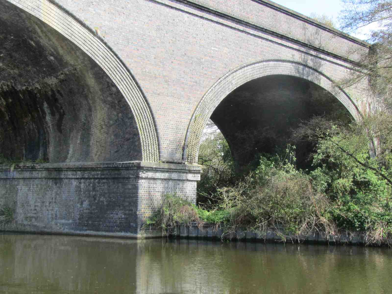
Next we passed under the graceful arches of the tall brick railway bridge that carries Chiltern trains from London Marylebone to Birmingham and to Aylesbury via Amersham. We saw posters opposing the HS2 plans for a high speed link from London to Birmingham. From reading these it seems the plans are to take a new route from very close to this bridge, northwards, across the valley (river and canal) on a 3.6km long new viaduct. These means it would cross the River Colne valley, Grand Union canal and adjoining country park land that includes rare vegetation and wildlife.


At Widewater Bridge and lock area we quickly had a sandwich and drink before sheltering under the road bridge during a heavy downpour of rain. We watched a nearby heron patiently waiting for a fish, so still that some people thought it was plastic. It did catch some dinner and we saw it being swallowed! 

When the sun re-emerged we continued to Black Jack’s Lock, another very pretty location (once featured in Doctor Who programmes), with cottage and a former mill, now a B& B.
 
We did stop for a cuppa at the popular and old Coy Carp pub (formerly called The Fisheries) at Copper Mills on the outskirts of Harefield. Nearby, is an attractive row of old cottages, Copper Mills Lock and a small canoe slalom course where the water from an outfall into the canal was white.  There was once a paper mill here and this was later converted to the making of copper sheets for the bottoms of Royal Naval boats, hence the area’s name.


Towards the end of our walk we passed Maple Lodge Sewage treatment works (a bit whiffy).


We added more birds to add to our list of species seen today (including Pied and Yellow wagtails). The cormorant swam along with us for a while, towards the end of our walk, and the male chaffinch and mallard duck were very obliging while being photographed.


It started to rain again as we approached Springwell Lock and we were glad to get in the dry again after an enjoyable walk.


Saturday, 7 April 2012

Saturday 7th April 2012 Ramble 3: Hayes to Uxbridge


Ramble 3: Hayes and Harlington Station to Uxbridge, approximately 5½ miles on a cold and cloudy day.
We parked the car at Hayes and Harlington railway station, the start of our walk.


This morning we started along the towpath from bridge No 200, near a milestone telling us that we were 87 miles from Braunston (note Grand Junction Canal Company initials at the top). We made good progress, having started a little earlier than normal. We were rewarded with sights of a jay, goldfinches and ring-necked parakeets. Later on we saw a pied wagtail.


This time there were more plants flowering too and for the first half mile or so we saw many bluebells and ‘whitebells’ alongside the towpath.


Soon after we started, a group of cyclists with matching-shirts passed us. This happened several times during the walk and we worked out they were on a sponsored cycle ride. Other than that, there seemed to be fewer cyclists, walkers and joggers, compared to our previous walks. 


Again, behind high fencing, we passed many light industrial estates and on the West Drayton side of the canal saw a large bus depot and an aggregates works site (Hanson’s, with a small wharf on the canal). We heard many trains but rarely spotted one until we were nearer West Drayton railway station which is alongside the canal. 


Just a little further on, after more housing estates, more boats and houseboats were moored along the canal. We were approaching Cowley Peachey Junction. Here the Slough arm of the Grand Union canal branches off. It is about 5 miles to Slough and this arm was one of the last canals to be built (1882). Initially, the main traffic along the waterway was bricks made from clay from the local pits through to Slough. These were used to help London’s expansion and development. Later on, when the clay pits were exhausted, refuse was taken out from London to backfill them.


Cowley Peachy is a busy place as there is a large area for moored boats named Packet Boat Marina and associated businesses.  Just ahead is the first lock we have encountered since leaving Paddington basin. For many years the Paddington Packet Boat, pulled by four horses, travelled once a day along this route. This passenger carrying boat had precedence over other boats, had a smart uniformed crew and was known to be very fast. It was here that we saw a duck house (that didn't cost £16,000 I hope) and the flower pot men.


We stopped briefly at Cowley Lock for a cup of tea at the newly opened Toll House Bistro. A book registering the tolls taken was on display in a glass case. The lock was being used and some of the associated houses were up for sale.


 The last stretch of canal that we walked along today was increasingly built up. One interesting area was a boat yard where I guess many a boat has been built and fitted out.


We finished at the Swan and Bottle PH, a smart looking pub near to Uxbridge shopping centre. 


We returned from here to our car on the U4 bus from the centre of Uxbridge. The route took us past the site of RAF Uxbridge where Lord Dowding was based during the Battle of Britain. Although the base is now closed and being redeveloped the underground bunker is preserved and open to the public (long waiting list apparently).


Tuesday, 27 March 2012

Saturday 24th March 2012 Ramble 2: Perivale to Hayes


Saturday 24th March 2012
Ramble 2: Perivale to Hayes and Harlington Station; approximately 6½ miles, along the Paddington Arm of the Grand Union Canal.
We arrived at Perivale, the start of our second walk along the Grand Union Canal, late morning, having driven to London. We left the car at Hayes and Harlington railway station and travelled by train and bus to Perivale.
The weather was very foggy and a bit cold to start with, but it turned out to be a gloriously warm, spring day (21 degrees).

We re-joined the canal by Ballot Box Bridge No. 13 (see picture) and continued along the Paddington Arm of the Grand Union Canal. This arm of the GUC was completed in 1802 and allowed boats to get to Limehouse docks without using the tidal River Thames.  For about two miles the towpath is part of the Capital Ring route; easily followed by green metal signs. Incidentally, from Little Venice to Cowley Lock near Uxbridge (which we will pass on the next walk) there are no locks so boating must be great.
  
On our map we saw that we were to pass a nature reserve –our hopes were raised – but it was behind high fencing and locked gates with no access from the canal. In all, we did see much wildlife including two ring-necked parakeets flying, a cormorant and many coots, swans, geese, ducks and a few moorhens (that don’t seem as shy as they once were).


We were warned by a returning cyclist that the towpath was closed ahead for repairs. We carried on along the uneven surface, not wishing to do another long detour and hoped this wasn’t going to be a feature of all our walks!


The next building of note that we passed was the Dawoodi Bohra mosque in Northolt. The picture doesn’t do it justice and it is hard to grasp the scale of the building. Later we were to see the golden top of Sri Guru Singh Sabha Gurdwara in Southall, the largest Sikh temple outside India.  


This walk was much ‘greener’ than GUC Day 1. The days seem long gone when large food manufacturers (J. Lyons, Heinz and others) paper and flour mills, brick works and potteries, aviation industries etc were all along the sides of the canal. Only a few names give clues to its past i.e. Lyon’s Bridge. Wikipedia tells me the Lyon’s factory, Greenford unloaded nearly 500kg of tea a week in the 1920s. It came by barge from the Limehouse basin docks, was blended and packed and sent on its way (again mainly by barge)!


There are many new housing developments too, built on land that was once industrial.  The picture to the right is of Grand Union Village and Engineers wharf. There were many light industrial units but they were generally slightly away from the canal, often behind high fencing.  A giant Tesco Extra near to Bull’s Bridge (see below) is on the site of a former yard where boats for the maintenance of the canal were built and repaired. Obviously this was a key site as it was at the junction of the Paddington arm and main Grand Union Canal. As we approached, the canal going to the left joins the River Thames at Brentford, (after about 12 miles) and to the right (where we head off to) goes north to Birmingham. 
It is also here that we saw two derelict houses ripe for demolition; one of them is Junction House.


The vast majority of the old wharves and docks have been filled in. It was here that enormous amounts of coal, necessary to fuel the local industries, were unloaded, having been transported by barge from mining areas in the midlands and north. One celebrated and re-enacted bi-annually, is the Jam ‘Ole run. The boaters in fierce competition with each other, (as they were paid by the tonnage of coal transported) took coal from Baddesley Colliery, near Atherstone, Warwickshire to Mitre Lock, Southall for the Kearley and Tonge’s jam factory in a punishing 7 days.  It is necessary to travel 240 miles along the canal and through 204 locks to do this and the last run was in 1970, ending a tradition of two centuries. It would be lovely to see the boats in the re-enaction.


One enormous factory still operating is Nestlé. This is very close to Hayes and Harlington railway station and the smell of Gold Blend is all around.


The end of the walk took us past the enormous High Point Village; a complex of 600 apartments, a hotel with 120 rooms along with an “aparthotel” (140 apartments, due to open in May) and associated gyms, swimming pool, shops etc. This is all situated on canalside land (that was previously a railway goods yard) and can be seen in the background of the picture above, beyond NestlĂ©.

Wednesday, 7 March 2012

Saturday 3rd March 2012 Ramble 1: Little Venice to Perivale


Ramble 1: Little Venice to Perivale, approximately 6½ miles, along the Paddington Arm of the Grand Union Canal.
We arrived at Little Venice about 11am for the start of our first walk along the Grand Union Canal, having travelled by train and underground through St Pancras to Paddington station.

Little Venice was quiet. A few boats were moored (the closed up puppet theatre canal boat being one), but the only active things on the water were a few ducks and geese. We went by the old Toll Bridge House where commercial canal boats were gauged in the days when the canal was an active trading route.  Here there is a stop lock, built during WWII as a defence against flooding, at the entrance to the Little Venice basin where many houseboats are moored (including the one used by Richard Branson in the early days of Virgin). The smell was of wood smoke and diesel fumes.


We were soon walking under a flyover of the A40 Westway which seemed to soar precariously over the canal towpath, supported by the slimmest of structures.


Trellick Tower in North Kensington, a 31-storey high block of (originally all) council flats with its adjoining service and access tower couldn’t be missed from a little further along the towpath. The block was designed by the architect Goldfinger in the ‘brutalist’ style and completed in 1972. Apparently the flats are more sought after these days, after their low-life beginnings.


After passing a new development (including smart-looking flats in a former water tower) in the Portobello dock area, Kensal Green Cemetery could be seen, (but not entered into unless as part of a tour) on the opposite side of the canal. This, amazingly big (72 acre) site holds the remains of more than 250,000 people including Isambard Kingdom Brunel and Charles Babbage, the ‘father of computing’.


We carried on over an old brick bridge that spans an entrance to a side basin marked Gas Works on the map. This bridge, along with a few others and the Toll House at Little Venice were the only obvious relics we saw of the long past canal trading days. Surprisingly, all trace of former wharves with their lifting equipment and associated buildings have been demolished.


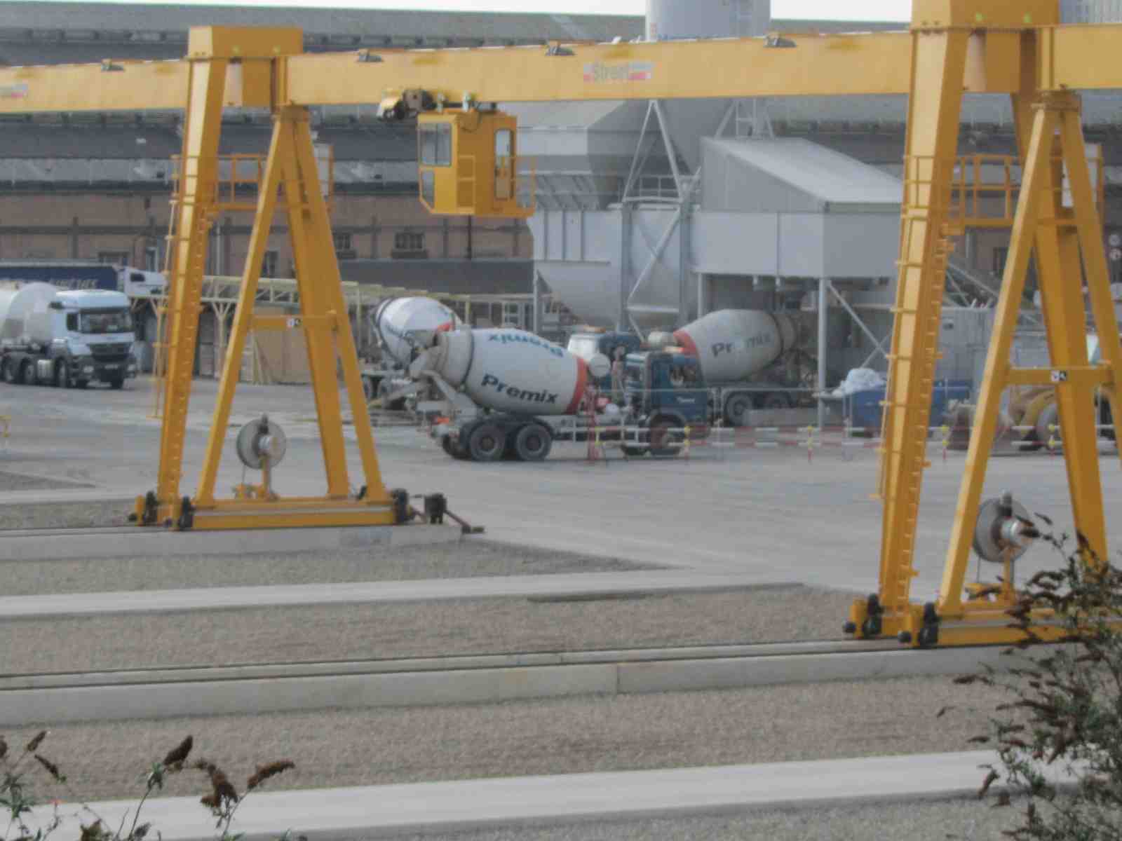
Further on, alongside Old Oak railway sidings we spied many hundreds of pre-cast concrete tunnel sections and associated concrete making facilities. We thought that these were destined to go into making the 21 kilometres of twin-bore tunnels under central London, part of the Crossrail project.


Also, around here we could see Wembley stadium’s characteristic white steel arch that Wikipedia tells me is the longest single span (317m) roof structure in the world.

At Old Oak Lane Bridge the canal towpath was temporarily closed as a crime scene. This meant we had to divert around to Acton Lane Bridge, past Willesden Junction railway station, the depot where Eurotunnel trains are serviced and McVities biscuit factory.


Just after the Katsouris food factory, with its accompanying curry smells, the canal passes over the North Circular road (A406) by means of an aqueduct. The photos taken don’t seem to relay the height of this engineering feat above the busy traffic below.


Much of the time we were dodging helmeted cyclists and Lycra-clad runners; all keen to make faster progress than us.

In parts, the canal had (the backs of) factories, small industrial units and shops alongside. Elsewhere, there are residential buildings of all kinds; modern tower blocks, rundown terraced houses, flats with balconies, many of them dilapidated.
Gradually as we walked towards our goal, green space appeared between buildings, as high-rise central London transformed into suburbia. By the time we reached Perivale along with the endless rows of houses and gardens there were more playgrounds and a large golf course. Thankfully, it also has less smelly rubbish, less graffiti and less high metal fencing. It appears that the first half of the Paddington arm of the Grand Union Canal has, in estate agent’s speak, much potential for upgrading.
Despite the odds, one delight to see were a group of coltsfoot plants flowering at the canal edge. Other plants seen flowering were daffodils, blackthorn and pussy willow.  We also saw some swans nesting and plenty of pigeons (rock doves).